


ISRO BHUVAN INDIAN LIVE
Description of ISRO BHUVAN INDIAN LIVE
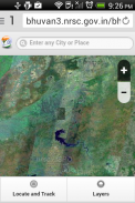
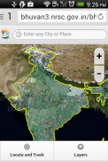
Bhuvan is an application developed by ISRO that provides 3D satellite imagery of Indian locations. This tool allows users to explore various geographical features and view detailed imagery with spatial resolutions ranging from 5 to 100 meters. Bhuvan is available for the Android platform, making it accessible for users who wish to download the app and utilize its functionalities.
Users can interact with the application to view locations from different perspectives. The interface is designed to be user-friendly, enabling individuals to navigate through diverse landscapes easily. The app focuses on providing high-resolution satellite images that offer more detail than many other virtual globe software. This feature is particularly beneficial for users interested in geography, urban planning, and environmental studies.
Measurement capabilities are also integrated into the application, allowing users to measure distances between points on the map. This function can be useful for various practical applications, such as planning travel routes or analyzing land usage. The app is designed to operate effectively even on slow internet connections, making it suitable for a wide range of users, including those in rural areas with limited connectivity.
Bhuvan emphasizes security by omitting images of military installations within India. This aspect reflects the application's commitment to maintaining national security while providing valuable geographic information to the public. The imagery can include urban areas, natural landscapes, and significant landmarks, which can be useful for both personal exploration and professional projects.
The app's mapping capabilities extend beyond just viewing images. Users can engage with different layers of information, offering insights into various geographical and environmental factors. This can include data related to land use, vegetation, and hydrology, which can be particularly interesting for researchers and students in related fields.
In addition to standard map views, Bhuvan offers features that allow users to visualize changes over time. This can be particularly informative for users interested in understanding environmental changes, urban expansion, or other developmental trends. By comparing different time periods, users can gain insights into how specific areas have evolved.
The application also provides options for users to create and save their personalized maps. This feature enhances the user experience by allowing individuals to focus on specific areas of interest. Users can mark important locations, draw routes, and annotate maps, which can be useful for both personal projects and professional presentations.
Bhuvan's design takes into account the need for accessibility and ease of use. The navigation is straightforward, enabling users to zoom in and out of areas seamlessly. The application supports various devices, ensuring that users can access the tool from different smartphones and tablets without compatibility issues.
For users interested in environmental monitoring, Bhuvan includes resources that can assist in tracking changes in land cover and usage. This can be particularly relevant for conservationists, urban planners, and researchers who require accurate and up-to-date information for their work.
The app also serves educational purposes, providing a platform for students and educators to engage with geographic information. Teachers can utilize the application as a teaching tool, allowing students to explore and analyze different geographic data in an interactive manner. This can enhance learning experiences and promote interest in geography and environmental science.
Bhuvan has a community aspect as well, as users can share their findings and maps with others. This collaborative feature encourages knowledge sharing and can foster community engagement, especially among those interested in geography and related fields.
In terms of updates and improvements, ISRO continues to develop Bhuvan, aiming to enhance its capabilities and provide users with even more features. Regular updates ensure that the app remains relevant and useful, catering to the evolving needs of its user base.
The application is also a part of ISRO's broader efforts to promote awareness and accessibility of satellite data among the public. By providing a tool that allows users to visualize and interact with satellite imagery, Bhuvan plays a role in increasing public knowledge about geography and environmental issues.
In conclusion, Bhuvan offers a range of features that cater to both casual users and professionals interested in geographic information. Its detailed satellite imagery, measurement tools, and user-friendly interface make it a valuable resource for various applications, from education to urban planning and environmental monitoring. The app facilitates exploration and analysis of Indian landscapes, contributing to a better understanding of geography and land use across the country.
ISRO BHUVAN INDIAN LIVE - Version 3.1.0
(27-06-2017)ISRO BHUVAN INDIAN LIVE - APK Information
APK Version: 3.1.0Package: com.prajwal.history.science.isro.bhuvan.earth.map.satelliteLatest Version of ISRO BHUVAN INDIAN LIVE


Apps in the same category


You may also like...


